
Bạn cần biết ranh giới đất của mình nằm ở đâu. Có thể bạn đang lên kế hoạch xây hàng rào và không muốn xây lấn sang đất của hàng xóm. Có thể bạn cần xác nhận mình đang nằm trong khoảng lui trước khi đổ bê tông sân hiên. Hoặc có thể bạn vừa mua một thửa đất và diện tích được ghi trên hợp đồng không khớp với những gì bạn cảm nhận khi đi bộ quanh khu vực đó.
Một chuyên viên đo đạc có chứng chỉ có thể trả lời những câu hỏi này một cách dứt khoát, nhưng một cuộc khảo sát ranh giới có thể tốn từ $400 đến $900 cho một lô đất ngoại ô và $1.000 đến $3.500 cho đất nông nghiệp. Đối với nhiều tình huống thông thường, bạn hoàn toàn có thể tự xác định ranh giới đất bằng các phương pháp miễn phí hoặc chi phí thấp chỉ mất một buổi chiều. Hướng dẫn này trình bày bảy phương pháp thực tế. Hầu hết chủ nhà đạt kết quả tốt nhất khi kết hợp hai hoặc ba phương pháp với nhau.
Tại Sao Bạn Cần Biết Ranh Giới Đất
Ranh giới đất có ảnh hưởng thực sự đến hầu hết mọi dự án ngoài trời bạn thực hiện.
Hàng rào. Một đường hàng rào được dựng lệch dù chỉ vài inch sang phía sai của ranh giới đất có thể bị yêu cầu tháo dỡ với chi phí do bạn chịu. Hầu hết các nhà thầu xây hàng rào khuyến nghị đặt hàng rào cách ranh giới 6 đến 12 inch về phía đất của bạn như một biên độ an toàn, nhưng điều đó chỉ có tác dụng nếu bạn biết ranh giới ở đâu.
Công trình xây dựng và khoảng cách lui. Hầu hết các địa phương đều áp dụng yêu cầu về khoảng cách lui: khoảng cách tối thiểu giữa các công trình và ranh giới đất. Nhà kho, sàn gỗ ngoài trời, các phần mở rộng và nhà để xe đều phải tuân thủ yêu cầu này. Xây trong khoảng lui mà không có phương án phê duyệt đặc biệt sẽ có nguy cơ bị phạt hoặc bị buộc phá dỡ.
Cảnh quan sân vườn. Cây trồng trên ranh giới trở thành tài sản chung ở nhiều khu vực pháp lý. Tường chắn ảnh hưởng đến thoát nước trên đất của hàng xóm có thể tạo ra trách nhiệm pháp lý. Biết ranh giới của bạn trước khi khởi công giúp tránh những chỉnh sửa tốn kém sau này.
Mua đất. Khi mua bất động sản, đặc biệt là đất thô, diện tích được ghi đôi khi không khớp với thực tế. Tự mình đi quanh ranh giới sẽ giúp bạn tự tin hơn trước khi chốt giao dịch.
Phương Pháp 1: Kiểm Tra Giấy Tờ Chứng Nhận Quyền Sở Hữu và Bản Đồ Phân Lô
Giấy tờ chứng nhận quyền sở hữu đất của bạn chứa mô tả pháp lý về thửa đất, và trong hầu hết các trường hợp cũng có bản đồ phân lô thể hiện kích thước lô đất bằng hình ảnh. Nếu bạn không có bản sao, văn phòng lưu trữ quận huyện của bạn lưu hồ sơ của mọi giao dịch bất động sản. Nhiều quận huyện hiện cung cấp cổng tra cứu giấy tờ trực tuyến miễn phí.
Cách Đọc Mô Tả Giấy Tờ Cơ Bản
Mô tả bất động sản ở Hoa Kỳ sử dụng một trong ba hệ thống:
- Metes and bounds (ranh giới bằng phương vị và khoảng cách) (phổ biến ở các bang miền đông): đọc như hướng dẫn đi bộ với phương vị la bàn và khoảng cách từ điểm xuất phát.
- Lot and block (lô và khối) (hầu hết các khu dân cư ngoại ô): tham chiếu đến bản đồ phân lô đã được đăng ký thể hiện kích thước lô chính xác.
- Section, township, and range (khu vực, thị trấn và dải) (các bang miền tây và trung tây): mô tả thửa đất của bạn như một phần của ô lưới vuông một dặm vuông.
Ghi lại các kích thước chính: chiều mặt tiền, chiều sâu, tổng diện tích và số lượng góc. Nếu giấy tờ của bạn đề cập đến bản đồ phân lô, hãy lấy bản đồ đó từ quận huyện. Những con số này sẽ giúp bạn xác minh mọi thứ khác bạn tìm thấy.
Phương Pháp 2: Tra Cứu Bản Đồ GIS / Bản Đồ Thửa Đất Trực Tuyến của Quận Huyện
Đây là nguồn miễn phí hữu ích nhất để tìm ranh giới đất, và hầu hết mọi người không biết nó tồn tại. Phần lớn các quận huyện ở Hoa Kỳ công bố dữ liệu thửa đất thông qua các cổng GIS trực tuyến miễn phí hiển thị ranh giới đất trên ảnh hàng không.
Sử dụng GPS và ảnh vệ tinh để xác định ranh giới đất
Tìm kiếm tên quận huyện của bạn cộng với "GIS map" hoặc "parcel viewer." Khi bạn tìm được cổng, hãy tra cứu theo địa chỉ hoặc số thửa đất. Thông thường bạn sẽ thấy đường viền thửa đất trên ảnh vệ tinh, kích thước lô, diện tích, thông tin chủ sở hữu liền kề, và đôi khi có cả dữ liệu quy hoạch.
Lưu Ý Về Độ Chính Xác
Đường ranh giới GIS của quận huyện chỉ là ước lượng, không phải đường ranh giới pháp lý được khảo sát. Chúng được số hóa từ bản đồ phân lô đã đăng ký và căn chỉnh lên ảnh hàng không, và sự lệch có thể từ 5 đến 20 feet, đôi khi nhiều hơn ở vùng nông thôn. Dữ liệu GIS rất hữu ích như một lớp tham chiếu, nhưng đừng bao giờ coi đó là ranh giới pháp lý chính xác. Chụp màn hình vào điện thoại trước khi ra ngoài.
Phương Pháp 3: Tìm Các Mốc Ranh Giới Thực Địa
Khi đất của bạn được khảo sát ban đầu, người đo đạc đã đặt các mốc thực địa tại mỗi góc. Những mốc này được thiết kế để tồn tại lâu dài, và chúng thường vẫn còn trong đất hàng chục năm sau.
Các Loại Mốc
- Thanh sắt hoặc ống sắt. Loại phổ biến nhất. Thường là thanh sắt đường kính 1/2 đến 3/4 inch được đóng sâu 18 đến 24 inch vào đất, thường ngang mặt đất hoặc hơi thấp hơn.
- Cột bê tông. Mốc lớn hơn, thường 4 đến 6 inch vuông, đôi khi có nắp đồng thau được dập chữ.
- Cọc hoặc cờ khảo sát. Cọc gỗ tạm thời với băng dính màu từ các cuộc khảo sát gần đây. Chúng bị hỏng trong vòng một hoặc hai năm.
Tìm Mốc Bị Chôn Vùi Bằng Máy Dò Kim Loại
Cọc sắt thường bị ẩn dưới cỏ hoặc một lớp đất mỏng. Một máy dò kim loại cơ bản (từ $30 đến $100 cho loại định vị, từ $100 đến $300 cho loại đa năng) có thể xác định vị trí của chúng. Bắt đầu tại vị trí góc ước tính từ giấy tờ hoặc dữ liệu GIS và quét chậm theo lưới phủ bán kính 10 feet. Khi phát hiện tín hiệu, dùng tua vít thăm dò đất để xác nhận. Đánh dấu các mốc đã tìm thấy bằng cọc gỗ hoặc băng dính sáng màu. Nhiều cửa hàng phần cứng cho thuê máy dò kim loại với giá từ $20 đến $40 mỗi ngày.
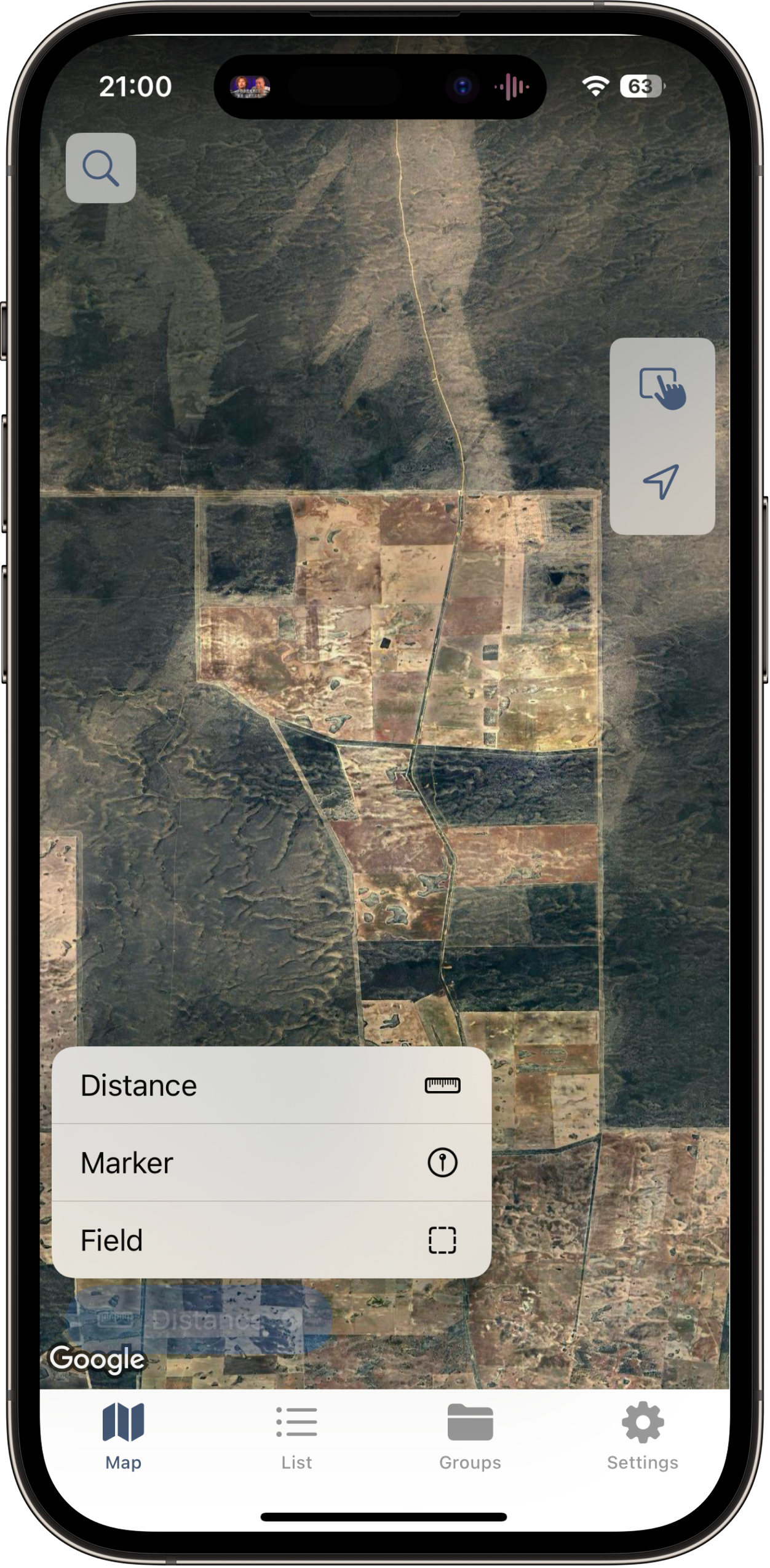
Phương Pháp 4: Sử Dụng Ứng Dụng Đo Lường GPS
Khi bạn đã có ý tưởng sơ bộ về vị trí ranh giới, ứng dụng đo lường GPS cho phép bạn đi dọc theo và tạo hồ sơ số với tọa độ, khoảng cách và tính toán diện tích.
Đi Dọc Ranh Giới với LandLens
Mở LandLens trên iPhone hoặc iPad của bạn và chọn công cụ đo diện tích. Hai cách tiếp cận hoạt động tốt:
Đặt ghim thủ công phù hợp nhất khi bạn đã tìm thấy các mốc góc. Đứng trên từng góc, chờ vài giây để GPS ổn định, rồi nhấn để thả ghim. Đi đến góc tiếp theo và lặp lại.
Chế độ theo dõi GPS tốt hơn cho các thửa đất lớn nơi bạn không thể xác định các góc chính xác. Đi dọc chu vi với tốc độ ổn định và ứng dụng tự động thả các điểm khi bạn di chuyển.
Đo ranh giới đất bằng GPS
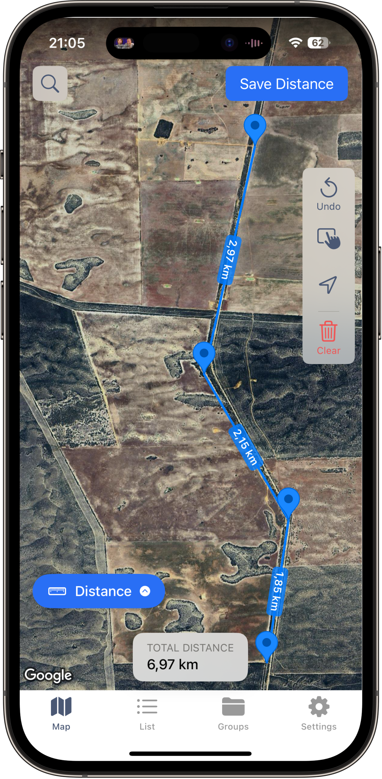
Ranh giới hoàn chỉnh với tính toán diện tích
Khi bạn đóng đa giác, ứng dụng hiển thị tổng diện tích và chu vi. So sánh những số liệu này với giấy tờ và dữ liệu GIS của bạn. Nếu diện tích chênh lệch trong vài phần trăm so với diện tích trên giấy tờ, phép đo của bạn là đại diện tốt cho ranh giới thực. Để có kết quả tốt nhất, hãy hiểu về độ chính xác GPS trên điện thoại: iPhone hiện đại thường chính xác đến 3 đến 10 feet trong điều kiện bầu trời quang đãng.
Phương Pháp 5: Kiểm Tra Bản Đồ Khảo Sát Bảo Hiểm Quyền Sở Hữu
Nếu bạn mua bất động sản bằng thế chấp, rất có thể một cuộc khảo sát đã được thực hiện khi đóng hợp đồng. Các công ty bảo hiểm quyền sở hữu và người cho vay thường yêu cầu điều này trước khi cấp bảo hiểm quyền sở hữu, và một bản sao có thể đang nằm trong hồ sơ đóng hợp đồng của bạn.
Hãy tìm trong tập hồ sơ đóng hợp đồng của bạn một tờ gấp riêng biệt thể hiện lô đất của bạn với kích thước, mốc góc, công trình và địa dịch. Nếu bạn không tìm thấy, hãy liên hệ với công ty bảo hiểm quyền sở hữu. Họ thường lưu trữ các bản đồ khảo sát trong nhiều năm.
Bản đồ khảo sát bảo hiểm quyền sở hữu cung cấp thông tin ranh giới chất lượng chuyên nghiệp mà không tốn thêm chi phí vì bạn đã trả cho nó. Hạn chế là tuổi của tài liệu: những bản đồ khảo sát này có thể đã nhiều năm hoặc vài thập kỷ tuổi. Đường ranh giới không thay đổi, nhưng các công trình và đặc điểm cảnh quan có thể đã thay đổi.
Phương Pháp 6: Hỏi Hàng Xóm
Hàng xóm của bạn chia sẻ ranh giới đất với bạn. Nếu bất kỳ ai trong số họ đã tiến hành khảo sát gần đây để xây hàng rào, mở rộng nhà hoặc mua đất, họ có thể có bản sao thể hiện ranh giới chung của bạn.
Giữ cuộc trò chuyện thoải mái: "Tôi đang lên kế hoạch xây hàng rào và muốn đảm bảo đặt nó đúng phía đất của tôi. Bạn có bản sao bản đồ khảo sát nào không, hoặc còn nhớ các cọc đất ở đâu không?" Hầu hết hàng xóm đều vui lòng chia sẻ vì điều này có lợi cho cả hai bên. Nếu họ đã có bản đồ khảo sát, hãy xin chụp lại phần liên quan.
Một lưu ý: ý kiến bằng lời của hàng xóm về vị trí ranh giới không phải là bằng chứng có tài liệu. Coi đó là một điểm dữ liệu để đối chiếu với giấy tờ, bản đồ GIS và các mốc thực địa của bạn.
Phương Pháp 7: Sử Dụng Ảnh Vệ Tinh và Các Đặc Điểm Nhìn Thấy Được
Ranh giới đất thường thẳng hàng với các đặc điểm nhìn thấy được bạn có thể phát hiện trên ảnh hàng không. Phương pháp này không xác định chính xác đường ranh giới, nhưng xác nhận những gì các phương pháp khác đang cho bạn biết.
Các đặc điểm thường theo ranh giới đất bao gồm đường hàng rào hiện có, đường cắt cỏ giữa các sân liền kề, hàng cây và bờ rào cây, cạnh lối đi xe dọc theo bên lô đất, và thay đổi trong sử dụng đất hoặc loại cây trồng nhìn thấy từ trên cao. Mở bản đồ GIS quận huyện hoặc chế độ xem vệ tinh và so sánh đường viền thửa đất với những đặc điểm này. Nếu bạn đã đi dọc ranh giới với ứng dụng GPS, hãy xem đa giác của bạn trên lớp vệ tinh để kiểm tra sự căn chỉnh.
Độ Chính Xác của Các Phương Pháp Này Như Thế Nào?
Không có phương pháp đơn lẻ nào đạt độ chính xác cấp khảo sát, nhưng kết hợp nhiều phương pháp giúp bạn đạt đủ gần cho hầu hết các mục đích thực tế.
| Phương Pháp | Độ Chính Xác | Chi Phí | Công Sức |
|---|---|---|---|
| Giấy tờ và bản đồ phân lô | Chính xác trên giấy; cần phương pháp khác để xác định ngoài thực địa | Miễn phí đến $5 | Thấp |
| Bản đồ GIS / thửa đất quận huyện | 5 đến 20 feet | Miễn phí | Thấp |
| Mốc ranh giới thực địa | Trong vài inch nếu tìm thấy | Miễn phí đến $40/ngày (thuê máy dò) | Trung bình |
| Ứng dụng đo lường GPS | 3 đến 10 feet | Miễn phí đến thấp | Trung bình |
| Bản đồ khảo sát bảo hiểm quyền sở hữu | Cấp chuyên nghiệp | Miễn phí (đã trả trước) | Thấp |
| Hỏi hàng xóm | Biến động rộng | Miễn phí | Thấp |
| Ảnh vệ tinh | 5 đến 30 feet (chỉ để xác nhận) | Miễn phí | Thấp |
Cách tiếp cận tốt nhất: bắt đầu với giấy tờ và bản đồ GIS để có kích thước ước lượng, tìm các mốc thực địa để xác định chính xác góc, rồi đi dọc ranh giới với ứng dụng GPS như LandLens để tạo phép đo có tài liệu mà bạn có thể đối chiếu với tất cả những thông tin trên.
Khi Nào Bạn Thực Sự Cần Thuê Chuyên Viên Đo Đạc
Các phương pháp tự làm trong hướng dẫn này hoạt động tốt cho mục đích lên kế hoạch và ước lượng. Nhưng một số tình huống đòi hỏi chuyên gia có chứng chỉ.
Tranh chấp pháp lý. Nếu bạn và hàng xóm không đồng ý về ranh giới và cuộc trò chuyện không giải quyết được vấn đề, một cuộc khảo sát chuyên nghiệp là bằng chứng duy nhất có giá trị trước tòa. Bản đồ khảo sát của chuyên viên có chứng chỉ là tài liệu pháp lý; phép đo GPS từ điện thoại của bạn thì không.
Giấy phép xây dựng. Nhiều cơ quan cấp phép xây dựng yêu cầu bản đồ khảo sát hiện hành khi bạn xin phép gần đường lui, đặc biệt cho các phần mở rộng nhà ở và đơn vị ở phụ.
Mua bán bất động sản. Các công ty bảo hiểm quyền sở hữu và người cho vay đôi khi yêu cầu bản đồ khảo sát trước khi đóng hợp đồng, đặc biệt với đất nông thôn hoặc bất động sản có giá trị cao.
Phân lô. Chia thửa đất của bạn thành nhiều thửa đòi hỏi chuyên viên đo đạc có chứng chỉ để tạo bản đồ phân lô đáp ứng các quy định địa phương.
Xâm phạm ranh giới. Nếu công trình của hàng xóm vượt sang đất của bạn hoặc ngược lại, một cuộc khảo sát chuyên nghiệp sẽ xác lập sự thật. Ở nhiều tiểu bang, các trường hợp xâm phạm lâu dài có thể dẫn đến yêu cầu quyền sở hữu do sử dụng sau 5 đến 20 năm.
Dự kiến chi trả từ $400 đến $900 cho một cuộc khảo sát ranh giới nhà ở, từ $1.000 đến $3.500 cho đất nông nghiệp, và từ $2.000 đến $6.000 hoặc hơn cho một cuộc khảo sát ALTA/NSPS. Nếu bạn thuê chuyên viên đo đạc, chia sẻ dữ liệu GPS từ LandLens sẽ giúp họ có cơ sở ban đầu cho công việc thực địa, điều này có thể giảm thời gian và chi phí.
Làm Thế Nào Để Tận Dụng Tối Đa Phép Đo GPS
Nếu bạn đang sử dụng ứng dụng GPS để đo ranh giới đất bằng GPS, các bước thực tế sau đây sẽ cải thiện kết quả của bạn.
Kết hợp GPS với bằng chứng thực địa. Sử dụng kích thước từ giấy tờ và bản đồ GIS để biết khoảng ranh giới cần nằm ở đâu. Tìm các mốc thực địa tại các góc. Sau đó sử dụng ứng dụng GPS để kết nối các điểm. Phép đo trở nên đáng tin cậy hơn nhiều khi được neo vào các điểm tham chiếu đã biết như cọc sắt hoặc cột bê tông.
Đo hai lần. Đi dọc ranh giới một lần, lưu lại, rồi đi lại vào một ngày khác. Độ chính xác GPS thay đổi khi vị trí vệ tinh thay đổi. Nếu cả hai phép đo đồng ý trong vài feet, bạn có thể tự tin vào kết quả.
Ghi chép mọi thứ. Khi bạn lưu phép đo, hãy thêm ghi chú về từng góc: "Tìm thấy cọc sắt dưới 2 inch đất" hoặc "Không tìm thấy mốc, ước tính từ GIS và giao điểm hàng rào." Những ghi chú này rất quý giá nếu bạn xem lại ranh giới sau này hoặc chia sẻ dữ liệu với chuyên viên đo đạc.
Xuất và lưu trữ. Bạn có thể xuất phép đo của mình dưới dạng KML để xem trong Google Earth, dưới dạng GeoJSON hoặc Shapefile cho các chuyên gia, hoặc dưới dạng báo cáo PDF với tọa độ và ảnh bản đồ. Lưu một bản sao cùng với hồ sơ bất động sản của bạn.
Biết giới hạn. GPS điện thoại chính xác đến 3 đến 10 feet. Điều đó đủ để lên kế hoạch xây hàng rào với biên độ an toàn, xác minh diện tích và tạo bản đồ tham chiếu hữu ích. Không đủ chính xác để thiết lập ranh giới pháp lý hoặc thay thế bản đồ khảo sát chuyên nghiệp khi cần thiết.
Kết Luận
Xác định ranh giới đất mà không cần chuyên viên đo đạc là khả thi cho hầu hết các tình huống hàng ngày. Bắt đầu với tài liệu: giấy tờ, bản đồ phân lô và cổng GIS quận huyện cho bạn kích thước và vị trí ước lượng mà không tốn chi phí. Ra ngoài và tìm cọc sắt, cột bê tông và cọc khảo sát. Đi dọc ranh giới với LandLens để tạo hồ sơ số bạn có thể đo, lưu và chia sẻ. Đối chiếu với bản đồ khảo sát bảo hiểm quyền sở hữu, kiến thức của hàng xóm và ảnh vệ tinh.
Khi nhiều phương pháp cùng chỉ về một đường ranh giới, bạn đã tìm thấy ranh giới đất của mình với đủ sự chắc chắn để lên kế hoạch xây hàng rào, bắt đầu dự án cảnh quan hoặc xác minh diện tích. Và nếu rủi ro cao, bạn sẽ biết chính xác khi nào đến lúc cần gọi cho chuyên gia.
Dùng thử LandLens miễn phí
Đo bất kỳ diện tích đất, khoảng cách hoặc chu vi nào bằng iPhone hoặc iPad. Không cần thiết bị.
Chia Sẻ Phản Hồi Của Bạn
Giúp chúng tôi cải thiện LandLens. Yêu cầu tính năng, báo cáo lỗi hoặc cho chúng tôi biết ý kiến của bạn.