Measure Any Land in Seconds
GPS-powered field measurement for Farmers
Area, distance, and perimeter — right from your phone
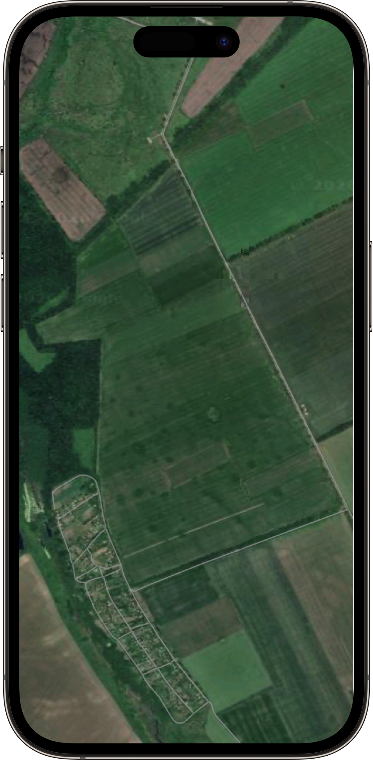
39.91 ha
780 m perimeter
Everything You Need to Measure Land
Professional-grade tools in your pocket. No expensive equipment required.
GPS Field Measurement
Walk or tap to measure any field with GPS precision. Track boundaries automatically as you walk the perimeter.
Area & Distance
Calculate area, perimeter, and distance in acres, hectares, square meters, or any unit you need.
Export Everything
Export to KML, KMZ, GeoJSON, PDF, and Shapefile. Share with your team or import into GIS software.
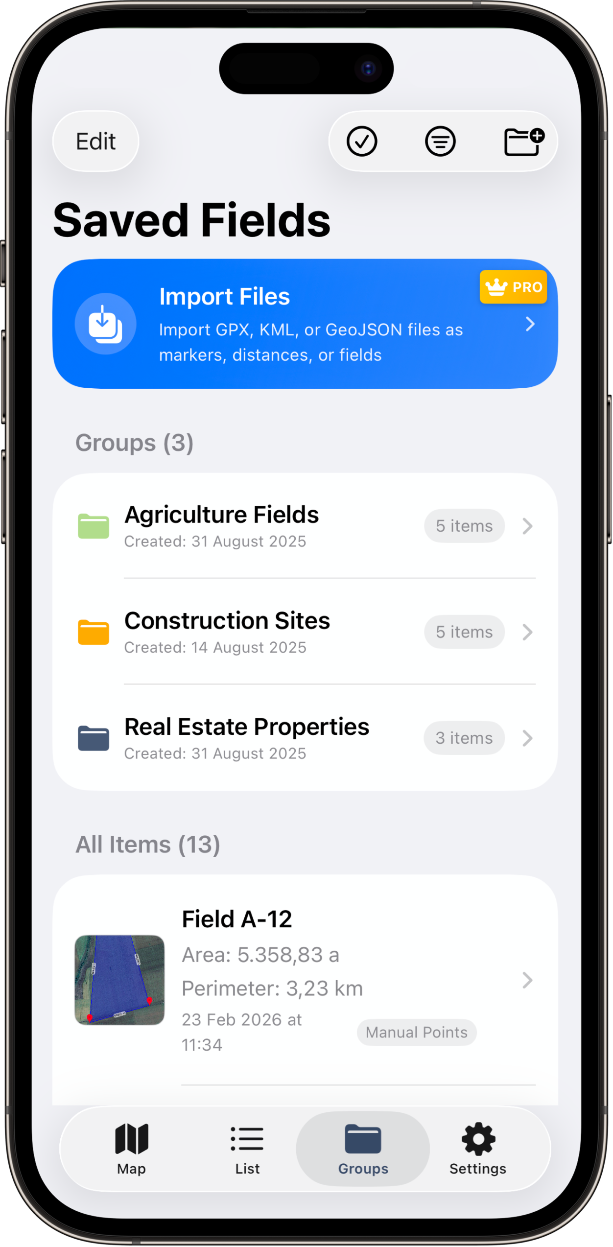
Organize with Folders
Color-coded folders to manage farms, sites, and properties. Keep all your measurements organized.
Works Offline
Measure in the field with no signal required. GPS works without internet. Sync when you're back online.
Cloud Sync
Auto-sync across all your devices. Never lose a measurement. Access your data anywhere.
Trusted Across Industries
From farmers to architects — professionals worldwide rely on LandLens for accurate measurements.
Farmers
Measure crop fields, calculate fertilizer needs, and plan irrigation systems
Land Surveyors
Conduct boundary surveys, document property lines, and create field maps
Real Estate Pros
Measure lot sizes, verify property boundaries, and generate listing reports
Engineers
Survey project sites, calculate earthwork volumes, and plan infrastructure
Landscapers
Measure yards, calculate material needs, and design outdoor spaces
Architects
Survey building sites, verify lot dimensions, and plan site layouts
Construction
Measure building lots, calculate excavation needs, and track site progress
Environmental
Map conservation areas, monitor habitat zones, and document ecosystems
Golf Designers
Design fairways, measure greens, and plan course layouts with precision
Outdoor Enthusiasts
Map hiking trails, measure camping areas, and explore outdoor spaces
How It Works
Three simple steps to measure any land area.
Drop Pins on the Map
Tap to place markers or walk the boundary with GPS tracking. Mark corners of fields, properties, or construction sites.
Get Instant Measurements
See area, perimeter, and distance calculated in real-time. Switch between acres, hectares, square feet, and more.
Save & Export
Organize in folders, export as PDF, KML, or GeoJSON. Share reports with clients, colleagues, or government agencies.
Built for Land Professionals
Whether you're farming, building, or selling — LandLens has you covered.
Precision Farming Made Simple
Measure crop fields, plan spraying routes, and calculate seed and fertilizer needs. Know the exact size of every field on your farm.
- Measure field boundaries while driving your tractor
- Calculate input costs per acre or hectare
- Export field maps to precision agriculture platforms

Loved by Professionals
See why thousands of land professionals trust LandLens every day.
“More accurate than my $10K equipment. Wish I found this years ago.”

“Had 48 hours to measure our inheritance property for court. This app saved me from losing in legal delays.”

“My GPS unit died in the middle of nowhere. This app on my phone finished the survey project.”

Simple, Transparent Pricing
Start free. Upgrade when you need more power.
Free
Forever free
- 5 saved measurements
- 2 exports per month
- GPS field measurement
- Basic measurement units
- Unlimited saves & exports
- Advanced field operations
LandLens Pro
per year · cancel anytime
- Unlimited saved measurements
- Export & import all formats (KML, GeoJSON, SHP, GPX, PDF)
- Unlimited folders & organization
- Advanced field operations (merge, split, cut)
- All measurement units
- Priority support
Prices shown in USD. Regional pricing applied — prices may be lower in your country.
Frequently Asked Questions
Got questions? We've got answers.
Start Measuring Land Today
Join thousands of farmers, surveyors, and land professionals who measure smarter with LandLens. Download free and see the difference.